At the same time, if i click on the WMS that obtained with GeoServer (using OpenLayers.js API), i can see at a tabular form the objects it finds in the configured sources.
Perhaps, i use the wrapper to ensure the same result? What are the classes, methods should be used? Surely there is a way.:dry:
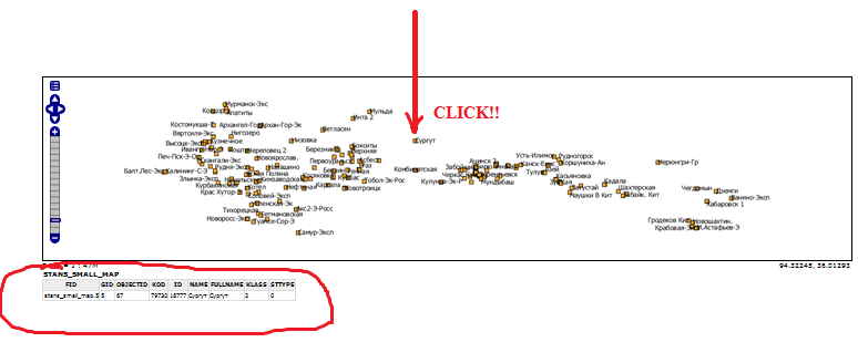
Operating with this information, click on the map, as well as an identifier of interest-GeoServer layer addresses configured as a source of spatial database and extracts all the necessary information, we can see in the “OpenLayers Map Preview”, click on WMS, produced by GeoServer:
VectorLayer and drawing mode POINT can indeed be used as “click listener”. There has been an almost ready patch in queue also for several moths that would provide click listener support without requiring vector layer. The contributor has just been bit busy to finish it. He is using it to get location from a WMS layer, then querying WFS (Geoserver if I remember correctly) for features at that point and finally doing some amazing stuff with the data.
I hope you can deal with VectorLayer based solution until the patch lands.